One World Terrain
Maxar is the prime contractor for the U.S. Army’s One World Terrain (OWT) program, which delivers 3D terrain and information services that support a fully accessible virtual representation of Earth through the U.S. Army network.
Mission data processing
Maxar was selected in 2020 to develop prototype mission data processing applications for the U.S. Space Force’s Future Operationally Resilient Ground Evolution Mission Data Processing (FORGE MDP) program. Maxar’s prototype applications provide rapid mission data processing and dissemination services for overhead persistent infrared data from the Space-Based Infrared System satellites.

Cloud-based GEOINT
Maxar’s Red Wing architecture, developed for the Air Force Research Laboratory, enables geospatial analysts to focus on addressing some of the most challenging intelligence problems by automating time-consuming workflows.
Tactical imagery access
The highly portable Maxar-built U.S. Army Remote Ground Terminal (RGT) provides critical GEOINT to warfighters in remote locations.
Superior Earth intelligence and mission architecture
Maxar enables the U.S. Department of Defense (DOD) and its allies to better monitor, understand and respond to global events, deter threats and ensure global security. Together, the many elements of Maxar can help the DOD meet its far-reaching modernization goals, maintain decision advantage, and rapidly identify and predict change.
EARTH INTELLIGENCE SOLUTIONS
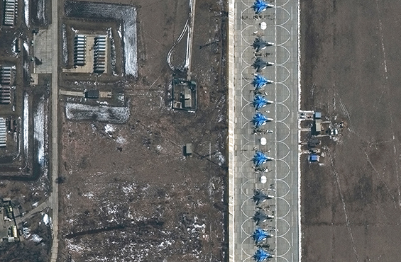
High-resolution commercial imagery
Maxar provides 90% of the commercial satellite imagery used to create foundation geospatial intelligence (GEOINT) for the U.S. government. With the launch of Maxar’s next-generation WorldView Legion™ satellites, our high-performance constellation will offer global revisit rates up to 15 times per day in addition to increased direct tasking opportunities and even more imagery at 30 cm class resolution.
Learn moreTactical Access Program
Rapidly produce, analyze and disseminate commercial data to support military, humanitarian and disaster relief missions. Maxar's mobile access terminals provide real-time, in-theater connection to satellite data and image processing—even in disconnected environments.
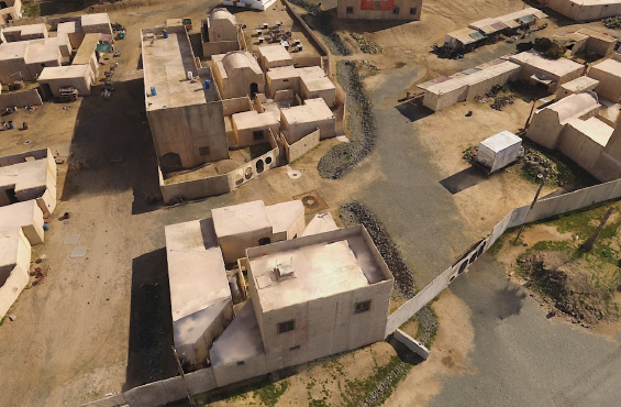
Learn moreThe Globe in 3D
Transforming 2D satellite imagery into 3D provides more information to intelligence analysts and more geolocation accuracy to warfighters. Maxar's 3D data and capabilities offer a foundation for military simulation and training in addition to a variety of tactical missions, and our Precision 3D Registration software automatically georegisters imagery to any spot on the globe.
Artificial intelligence and machine learning
Process multisource imagery to detect objects, identify patterns of life or generate targeting data with Maxar's DeepCore, an end-to-end artificial intelligence and machine learning pipeline for self-service computer vision analytics.
Learn moreAugmented and virtual reality
Leverage geospatially enabled virtual and augmented reality to interactively display large volumes of data over a high-resolution 3D base layer. Maxar's CityBox and WorldBox offer solutions for immersive, turnkey geospatial big data visualization and analytics.
Learn moreModeling and simulation
Generate physics-based metrics describing system performance, architecture analysis and collection satisfaction with Maxar’s BlueSim. With Maxar's BlueGround, optimize data with the rapid production of custom cloud-ready applications for GEOINT collection requirements management, collection feasibility and multivehicle scheduling.
Learn moreSPACE INFRASTRUCTURE SOLUTIONS
Space communications and mesh networking
Maxar is a leader in Ka, Ku, X, C, S and L-band satellite communications and is deploying advanced communications for V-band in volume. We also provide resilient, self-healing space mesh networking using optical intersatellite links and space-based Platform-as-a-Service software operating on constrained constellation nodes.
Secure processing
Multiagency satellite interoperability is a vital function for assured, resilient, low-latency connectivity in support of national security. With Maxar, rely on secure, trusted multidomain collaborative operations across ground, cloud and space.
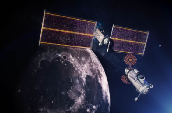
Spacecraft platforms
Maxar offers modular, flexible and cost-effective satellite platforms in LEO, GEO, cislunar and deep space that enable missions from Earth observation to communications and satellite-based augmentation systems. Compatible modules across key satellite characteristics—including power, propulsion, pointing, orbit and mass—operate on a unified system that enables custom configuration and structure.
Learn more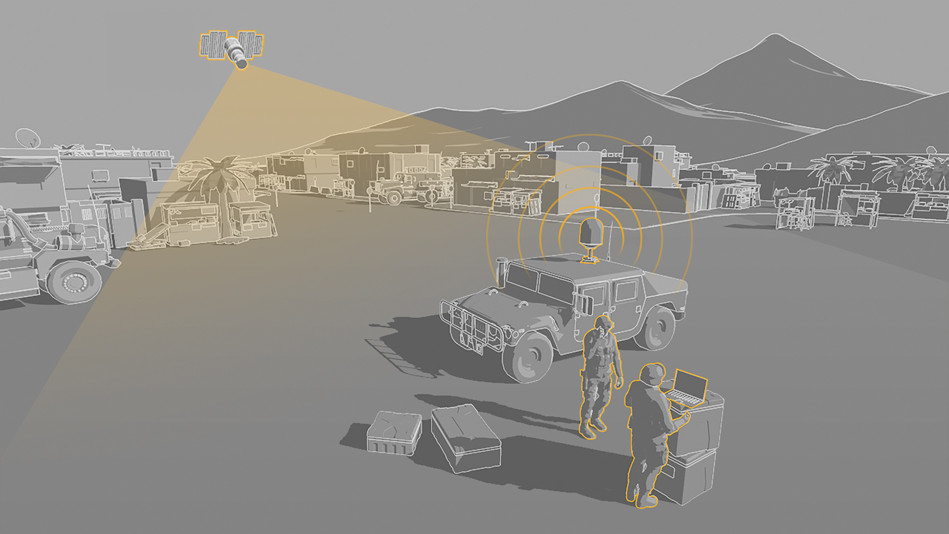
OUR COMBINED OFFERINGS
Explore the strength of Maxar’s combined offerings for next-gen missions through interactive graphics, service-specific downloads and more.
STAY IN TOUCH
Fill out the form below to receive updates on Maxar announcements, products and events relevant to DOD missions.
Contact us