Solutions for U.S. Civil Government

Helping civil governments serve their citizens

MAKING SPACE ACCESSIBLE AND INFORMATION ACTIONABLE 

For exploring deep space, analyzing land classification or responding to natural disasters, Maxar’s technology provides agile, scalable and cost-effective solutions for government missions.  

MAXAR’S SOLUTIONS IN ACTION 

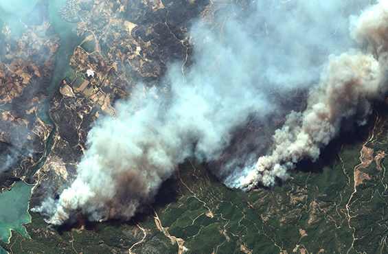
Open Data Program for disaster response 

When crises occur, Maxar supports local agencies and the humanitarian community by providing critical information to assist response efforts.
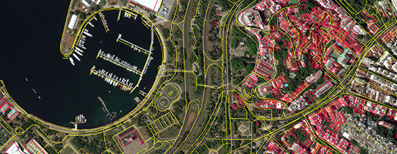
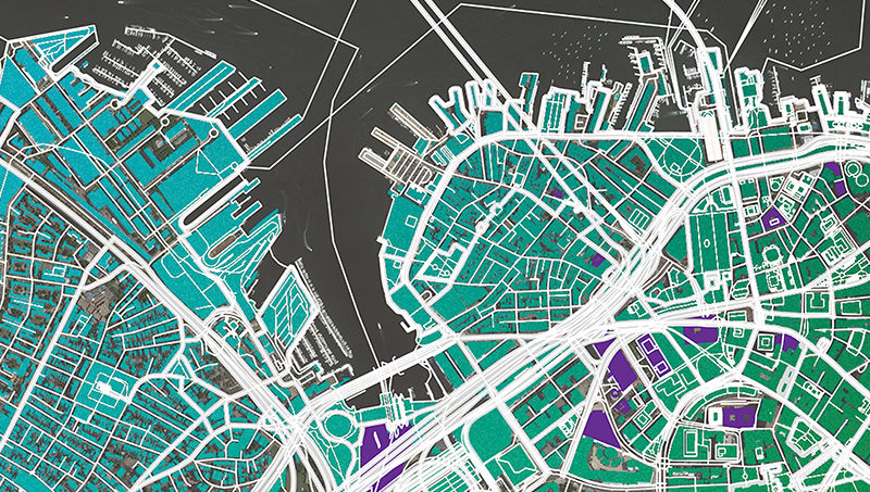
 Associated imagery and crowdsourcing layers are released into the public domain, allowing for rapid use and easy integration with existing technologies.  

Next-generation weather missions

Maxar spacecraft are trusted by Government Customers for weather monitoring missions, enabling our partners to share accurate, timely, and trustworthy weather data.

Modernizing census maps

Mapping can affect economic growth, public health systems, crisis response and more. Maxar's satellite imagery and machine learning help governments efficiently prioritize areas of change, compare large areas over time and extract countrywide structures.  

Power and Propulsion Element

Maxar is developing the Power and Propulsion Element (PPE) for NASA's Gateway, a lunar orbiting command module that will support human missions on the moon and set the stage for deep space exploration. As part of the Artemis program, PPE will be the highest-power electric propulsion spacecraft ever built.  

COMMERCIAL PLATFORMS FOR SCIENCE AND EXPLORATION 

Sixty years of investment and flight heritage enable Maxar to support U.S. government science, research and communications missions as a trusted partner that provides advanced solutions to match timelines and budgets. 

SPACE INFRASTRUCTURE SOLUTIONS 

Innovation in electric propulsion 

Our platform designs provide for all-electric orbit raising, enabling maximum operational lifetimes. And as a leader in chemical bipropellant systems, Maxar can customize propulsion based on customer needs for life span, timeline to orbit, mission, agility and payload mass.  

Learn more

Cutting-edge robotics 

Maxar leverages more than 30 years of space robotics heritage to deliver cutting-edge, agile systems. We offer multiple-axis robotics with functional redundancy, precise pointing accuracy, high torque, fine absolute position sensing and the ability to withstand extreme space environments. 

Learn more

Cost-sharing with hosted payloads

Hosting payloads on commercial satellites can help federal agencies gain access to space for scientific instruments, sensors and other small missions without the cost of building a dedicated spacecraft or procuring launch vehicle services.  

Learn more

EARTH INTELLIGENCE SOLUTIONS 

High-resolution satellite imagery

Satellite imagery is a critical tool for infrastructure monitoring, urban resilience, land governance and more. Diversity in resolution, currency, spectral bands and accuracy helps governments worldwide conserve resources, expedite operations, ensure compliance and save lives.  
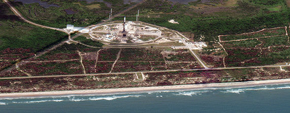
Learn more

Map data

Maxar mapping data products are useful for applications that go beyond pixels, such as wireless network planning, emergency response and energy operations.  

Learn more

Climate and weather tracking 

Make confident decisions about predicted weather conditions and changing climate with Maxar’s subscription-based applications powered by predictive analytics.  

Learn more

EXPLORE SPACE 

Travel from Earth to the moon, Mars and beyond with Maxar. This interactive journey highlights Maxar’s space heritage and future missions.  

Explore now

STAY IN TOUCH

Fill out the form below to discuss Maxar solutions with one of our representatives.  

Contact us