Maxar Spotlight
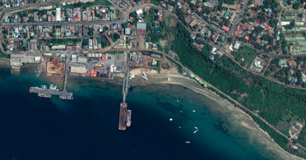
Leveraging high-resolution imagery for insight into violent extremism in Mozambique.
Advancing Earth Intelligence in the cloud
Maxar has worked with AWS for more than five years on innovative projects that have advanced the use of cloud storage and computing in Earth Intelligence, including being the first customer to transfer data from on-prem to the cloud using the AWS Snowmobile and demonstrating the transfer of a satellite image from collection in space to the cloud using AWS Ground Station in under a minute.

In 2020, AWS recognized Maxar with the AWS Public Sector 2020 Partner Award for Best High Performance Computing Solution.
Accelerating American GEOINT and space leadership
Governments around the world rely on Maxar Earth Intelligence and Space Infrastructure capabilities to better monitor, understand and respond to global changes.
Earth Intelligence
Maxar delivers timely, comprehensive and secure commercial geospatial intelligence (GEOINT) solutions that inform critical decisions and enrich classified resources across the U.S government and its allies.
Space Infrastructure
From space exploration to remote sensing and secure communications, agencies consistently turn to Maxar for proven expertise and ingenuity in systems engineering, spacecraft design and manufacturing, assembly integration and testing.
Some of Maxar's subscription platforms leverage the power of the cloud to bring insights to customers quickly.
Leveraging high-resolution imagery for insight into violent extremism in Mozambique.

Maxar reflects on NOAA's 50th anniversary and our collaboration since the first years of the agency.
Maxar wins AWS 2020 Public Sector Partner Award for Best High Performance Computing Solution.
This designation recognizes that Maxar has proven data, technology and expertise for helping customers leverage AWS for public safety and disaster response.
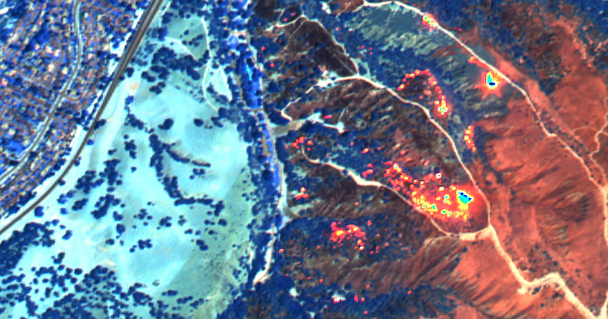
Maxar and Mapbox release interactive SWIR imagery map of California wildfires.
NGA and Maxar work together to expand government adoption of NOME—online access to collaborative mapping tools and current satellite imagery.