Vricon Explorer

A new way to look at a situation or an environment via 3D perspectives

Decades of experience yield unparalleled accuracy

Decades of experience yield unparalleled accuracy

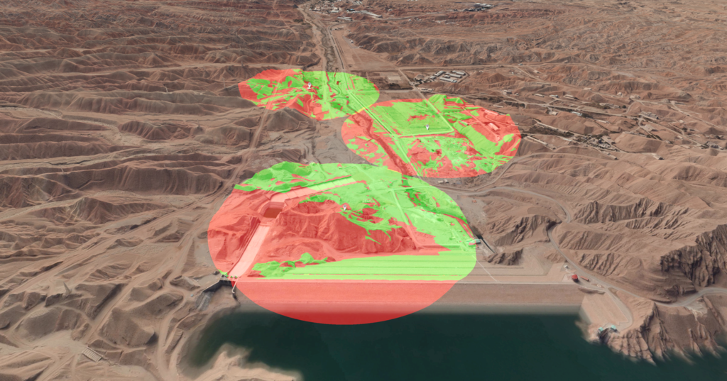
This software provides an optimized user experience for exploring the most accurate global 3D basemap available and enables you to add layers of information from your own data sources. Vricon Explorer empowers you to tell a story, interact with decision-makers and do analysis across your entire domain.

Using Vricon Explorer, you can:

icon

Annotate your scene to create POIs, lines, paths and polygons, and attach documents and reports.

icon

Perform viewshed analyses that flag vulnerabilities.

icon

Use 3D measurement tools (coordinate extraction, distances, areas).

icon

Use 3D analysis tools (height profiles, line of sight, viewshed).

Which edition is right for your mission?

Vricon Explorer

Vricon Explorer

Vricon Explorer allows users to visualize existing GIS datasets in 3D, determine accurate 3D coordinates, measure 3D distances and areas with paths and polygons, and perform advanced 3D analytics like rendering dynamic line-of-sight and viewshed graphics.


Maxar offers two commercial versions of Explorer: Lite and Pro. Pro has the same features as Lite, but it also includes export functionality and advanced analysis capabilities, such as slope, terrain height and water-level visualizations. It also provides for image georeferencing, image sequence generation and other features.

Explorer Targeting Edition

Explorer Targeting Edition

Vricon Explorer TE provides instant access to precise coordinates in an entire operational area. Targets are identified in the photorealistic 3D Surface Model, and coordinates are mensurated to the highest accuracy with an instant point-and-click operation. The identification and mensuration processes take mere seconds and require no setup or additional hardware.


The modern user interface—which is available for both tablets and desktops—is optimized for ease of use and reduces the need for training. Vricon Explorer TE supports visualization of risk-estimate distances (REDs) and Blue Forces in the tablet version. Combined with line-of-sight and viewshed calculations, these functions aid the risk-assessment process.

See for yourself

See firsthand the most accurate representation of Earth.

Request a demo