Prioritize
Rapidly prioritize resources and other data collections, based on where changes have occurred.
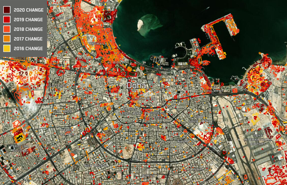
Identify and monitor relevant change at scale
Changes in infrastructure and land use are frequent and widespread, making it challenging for analysts to locate, map and monitor change over broad areas of interest. Persistent Change Monitoring (PCM™) highlights human changes in an area and displays persistent change accessibly as a color-coded geospatial data layer.
Traditional two-date change detection often presents false positives, attributable to factors like sun angle and harvested farmland. PCM™ uses extensive sampling to see past cyclical change and shine a light on the most important changes in an area.
Rapidly prioritize resources and other data collections, based on where changes have occurred.
Pinpoint where human change is happening on Earth’s surface.
Access cost-effective surveillance of hazards and construction over broad areas.
Examine historical change and deviations from patterns of growth and development.

Identify, understand and anticipate change across the globe.

Document human change at scale, and compare with more than two decades of archive data.

Monitor and prioritize resources to update critical geospatial infrastructure.
With more than 20 years of historical data, understand change over time in your area of interest.
Contact sales