
Rapid Access Program
Online access to a virtual ground system for time-sensitive missions
Our portfolio harnesses the latest innovations from Maxar Intelligence to give our customers the highest quality products available.
Direct collection requests and access to the world’s most advanced commercial imaging satellite constellation.
Online access to a virtual ground system for time-sensitive missions
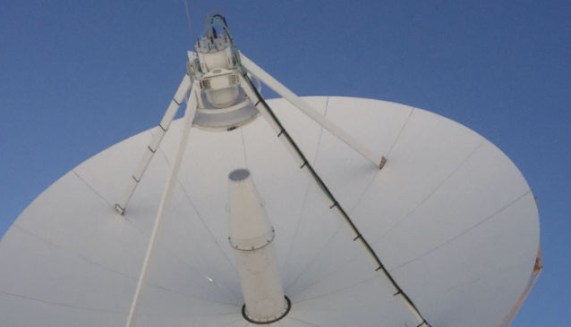
Direct satellite tasking for real-time imagery acquisition
Highest quality satellite imagery over any location on Earth.
Fresh collections as well as imagery from our archive dating back to 1999
Learn moreA near seamless and high-resolution view over large areas around the world
Learn moreDetect change through inclement ground conditions and at night
Learn moreImages of assets in space to navigate, understand and mitigate risk
Learn moreA precise digital twin of Earth for simulation, visualization and immersive environments.
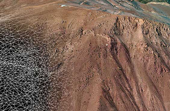
The most accurate representation of Earth
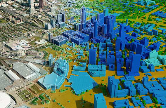
Next-generation 3D geodata for modern networks
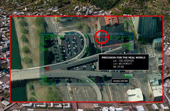
Quickly and accurately georegister your sensor data
Industry-leading technology, data and expertise to solve the most complex geospatial challenges.
On-demand subscription access and API integration to high-resolution satellite imagery with MGP Pro
Vessel detection and critical insight for maritime security agencies
The world’s largest professional-grade energy geospatial solution
Next-gen GPS resilience for autonomous systems
Learn moreOur wealth of geospatial expertise, global coverage plus comprehensive real-world experience is unmatched in the industry. For decades, Maxar Intelligence’s highly cleared engineers and software developers have supported critical customer missions.
Learn moreHaving the right solution for your mission, team and budget makes all the difference. Contact our sales team to gain more insight into which products or services are better fit to serve your needs.
Contact us